

Cairo, Egypt, the Triumphant City, known officially as al-Qāhirah is one of the world’s largest urban areas and offers many sites to see. It is the administrative capital of Egypt and, close by, is almost every Egypt Pyramid, such as the Great Pyramids of Giza on the very edge of the city. But there are also ancient temples, tombs, Christian churches, magnificent Muslim monuments, and of course, the Egyptian Antiquities Museum all either within or nearby the city.
Cairo, Egypt is an amazing city full of life and movement, and it is that way almost 24 hours every day, with the noisy honking of horns, children playing in the streets and merchants selling their wears and services. And here, the Egyptians are most at home in this powerful, modern and ancient city
Cairo, Egypt provides great culture, including art galleries and music halls, such as the Cairo Opera House, as well it should, being one of the largest cities in the world. It also provides some of the grandest accommodations and restaurants in the world, such as the Four Seasons and the Cairo Marriott.
Cairo offers an incredible selection of shopping, leisure and nightlife activities. Shopping ranges from the famous Khan el-Khalili souk, (or bazaar) largely unchanged since the 14th century, to modern air-conditioned centers displaying the latest fashions. All the bounty of the East can be here. Particularly good buys are spices, perfumes, gold, silver, carpets, brass and copperware, leatherwork, glass, ceramics and mashrabiya. Try some of the famous street markets, like Wekala al-Balaq, for fabrics, including Egyptian cotton, the Tentmakers Bazaar for appliqué-work, Mohammed Ali Street for musical instruments and, although you probably won’t want to buy, the Camel Market makes a fascinating trip. This is, and has been for over a thousand years, truly a shopper’s paradise.

In 1858, a museum was prepared at Boulaq, its contents collected by the French archeologist August Mariette. In 1880, the contents of the Boulaq museum was transferred to an annex of the Giza palace of Ismail pasha, the ruler of Egypt. The present museum was built in 1900, in
the neo-classical style by the French architect Marcel Dourgnon
This museum exhibits over 120000 objects including:
– the mummies of some pharaohs of the 18 to 20th Dynasty found in Thebes
– The contents of the royal tombs of Tuthmosis III, Tuthmosis IV, Amenhotep III and Horemheb and the tomb of Yuya and Thuya
– The famous treasure of Tutankhamon, consisting of more than 3500 Pieces of which 1700 objects are displayed in the museum

The pyramids of Giza are the only surviving Ancient Wonder of the World and one of the most famous tourist attractions in the modern world. They are some of the oldest sacred sites in our index and certainly among of the most impressive.
The Pyramids of Giza are the most famous monuments of ancient Egypt. These massive stone structures were built around 4500 years ago on a rocky desert plateau close to the Nile. But the intriguing Egyptian pyramids were more than just tombs for kings. The mysteries surrounding their symbolism, design and purpose have inspired passionate debate. It is likely that many of these mysteries will never be solved…

Part of the great Memphis necropolis, the Step Pyramid Complex at Sakkara presents the earliest pyramid in the development of the ancient Egyptian pyramid concept. Memphis was the capital of the Old Kingdom and was home to the burial chambers of countless kings and officials.
The Step Pyramid was built for the 2nd king of Egypt’s 3rd Dynasty, Kind Djoser, and is considered to be the foundation on which all later pyramids were based upon. The pyramid was built by a genius architect of the time, Imhotep, who based the theory of the pyramid on the more traditional ancient Egyptian funerary chamber the “mastaba”.
There are various theories regarding the method and stages of construction and also regarding the function of the many smaller buildings throughout the complex. Egyptologists continue to analyse and theorise as there doesn’t seem to be a solid framework that answers all questions. Nonetheless the complex reflects a true transition in ancient Egyptian development, in terms of aesthetics, architecture, as well as politics.
 Memphis was the capital of the Old Kingdom of Egypt, from its foundation (ca. 3100 BC) until 2200 BC. The ruins of Memphis are 19 km (12 miles) south of Cairo, on the west bank of the Nile. There are some extraordinary funerary monuments, including rock tombs, ornate mastabas, temples and pyramids. In ancient times, the site was considered one of the Seven Wonders of the World.
The site was added to the World Heritage List already in 1979, recognizing the universal admiration for the Pyramids, their antiquity and the exceptional civilization they represent.

The Bent Pyramid was probably the first planned from the outset to be a true pyramid, with smooth sides. This represents a glorious period in the evolution of the pyramid, comparable to that when Djsoer’s architect, Imhotep, built the Step Pyramid at Saqqara. The Bent Pyramid was probably either the first or second of Snefru’s pyramids, depending on who built the Medium Pyramid. It was almost certainly built prior to his other project at Dahshur, the Red Pyramid. The pyramid is also sometimes called the Rhomboidal, False, or Blunt Pyramid. The ancient Egyptians called it “Snefru Shines – South (pyramid)”.
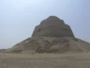
Just across from the Fayoum in the Nile Valley, south of Cairo, situated alone on the edge of the Western Desert above the lush green fields at Meidum is a tower shaped structure some sixty-five meters high that was once a pyramid that we believe was built by the 4th Dynasty King, Snefru (Sneferu, Snofru). However, there is no sure agreement on this among Egyptologists. Some believe that the early phases of construction were done by Huni, his predecessor, and that Snefru was only responsible for the completion of the Pyramid. However, Huni’s name was not found at the pyramid, and various written documents suggest that it and the nearby residential city belonged to the reign of Snefru. Also, many of the nearby tombs also belong to the family of Snefru.

One of Cairo’s most popular tourist attractions is the Citadel which houses a number of museums, ancient mosques and other sites, located on a spur of limestone that had been detached from its parent Moqattam Hills by quarrying. The Citadel is one of the world’s greatest monuments to medieval warfare, as well as a highly visible landmark on Cairo’s eastern skyline. Particularly when viewed from the back side (from the north), the Citadel reveals a very medieval character.
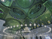 Mohamed Ali Mosque is amongst the most interesting Mosques in Egypt. It stands proudly on the highest point inside the courtyard of the Citadel of Saladin, and is also called the Alabaster Mosque. The architect was Yousf Boushnaq, a Turkish man who had come over from Istanbul to build this great Mosque for Mohamed Ali, the ruler of Egypt from1805 until 1849.
He based his plans on the Sultan Ahmed Mosque in Istanbul, and the construction began in 1830 A.D. The work continued ceaselessly until the death of Mohamed Ali in 1849, and had to be finished during the reign of his successors. Mohamed Ali was buried in the tomb situated on the south-eastern side of Beit Al Salah, on the right side of the entrance that leads to the main section.
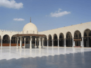
Amro mosque or Mosque of Amr Ibn Al-As is the first mosque built in Egypt and Africa and It was constructed by Amr Ibn Al-As in 642 AD.
Amr was the Arab general who conquest Egypt to fight against the Roman and He was hailed by the Copts as a liberator. Then he was appointed governor by the Caliph. Amr founded a new capital instead of Alexandria, and that was Al Fustat.
In he center of Al Futat was the mosque which later on was named “ The Mosque of Amr” It was surrounded by the plans and houses of Al Fustat. Originally the mosque was overlooking the Nile from the Northwest side.

This is one of the extraordinarily wonderful Islamic Monuments In the Islamic World. If Ancient Egypt is proud of the Pyramids of Giza, Islamic Egypt has to be proud of the Sultan Hassan Madrassa. The founder of this gigantic monument is the Sultan Hassan, son of the great Mamluke Sultan Al-Nasser Mohamed Ibn Qalawoun. Sultan Hassan ruled twice, the first time in 1347, when he was 13 years old, only to be dethroned by the other Mamluke princes and generals.
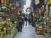
The Khan El-Khalili is one of the most interesting bazaars, not only in Egypt, but also in the whole Middle East.
Cafes, restaurants, shops, and large number of vendors and buyers constitute a dynamic panorama of the place. Drinking Hibiscus, Karakare, Helba, or any of the various typical Egyptian beverages, is a pleasant experience for visitors and guests to get a real taste experience. For smokers, there is the Shisha, or water pipe, to be tried.
Every visitor can take the opportunity to safely enjoy the walk through the narrow streets of Khan El-Khalili.
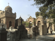
Old Coptic Cairo (Masr al-Qadima): This area is the oldest part of Cairo, and predates what is now modern Cairo. It is believed that there was a settlement here as early as the 6th century BC. Later, the Romans built a fortress here which we know today as “Babylon”. Some of these Roman walls still exist today.
After the spread of Christianity throughout Egypt, it became a Christian stronghold, with as many as twenty churches built within an area of just one square mile. Now only five remain, along with the earliest mosque ever built in Egypt. After the fall of Jerusalem in around 70 AD, the area saw an influx of Jews, and it’s here where Egypt’s oldest synagogue, Ben Ezra is located.
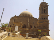
The church of St Sergius, Cairo. Considered to be Cairo’s oldest church, dating from the 4th century AD. Built on the spot where the Holy Family rested at the end of their journey into Egypt.
 The church of Saint George, Cairo. Originally built in 684 and rebuilt in 1857. It is best known for its wedding chamber, which dates from the 4th century AD and was reserved for marriage ceremonies.
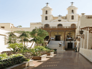
Cairo’s most famous church, may have been originally built in the 7th century on the site of an older 4th century church. Built on top of the Roman walls.

Exact date of construction unknown. Burnt in the Fustat fire of 750 AD and restored during the 11th century.

The Pharaonic Village began with a dream. Already famous for his rediscovery of the ancient techniques for making papyrus, Dr. Hassan Ragab had begun to ponder the possibility of a living museum with real people, actors in costume and in a realistic locale, taking the place of static exhibits. It was after a visit to Disney World’s EPCOT Center in Orlando, Florida, that his idea took root. Dr. Ragab believed EPCOT “was too computerized — there was nothing human about it. I began to think, ‘Dare I have real, live people in my village, dressed in the manner of three or four thousand years ago?'”
The Pharaonic Village is an experience like no other. The instant you begin sailing down the canals that circuit through the island you are immersed totally in the Egypt of history and legend.
The Pharaonic Village includes:
Tomb of Tutankhamun,
Ancient Arts & Beliefs Exhibit,
Islamic Exhibit,
Nasser’s Exhibit,
Art Center
Hellenistic Museum
Gift Shop, Cafeteria
Nefertari Yacht
Village Harbor
Nile Trip
Mythological Canal
Papyrus Plants
Playground
Garden
Pyramid
Coptic Exhibit,
Pyramid & Sphinx Exhibit,
Mummification Exhibit,
Napoleon’s Exhibit,
Anwar El Sadat Exhibit
Temple
Nobleman’s House
Peasant’s House
Ancient Boat Exhibit & Cleopatra’s Studio
Ancient Industries
Scenes of Ancient Agriculture
Scene of Moses.

Its nice to be up high in Cairo. It gives one a prospective view of this great city, with it’s very modern and very ancient districts. Anyone who has stood atop the Citadel or from the upper floors of some of the taller hotels is aware of the grand views that Cairo offers.
One of the best views is from the Cairo Tower, located on Gezira Island (Zemalak) just north of the Museum of Modern Art (which is also very much worth a visit), which provides a panoramic vision of Cairo. This 187 meter tall tower, in the form of a latticework tube that fans out slightly at the top, is said to imitate a lotus plant, and ranks only fourth among the worlds highest towers. It is made of granite, the same material often used by the ancient Egyptians, and is about 45 meters taller than the Great Pyramid at Giza.
To the late President Gamal Abdul Nasser, the Cairo Tower was the best place to dine out. He used to go together with his family to dine in the tower’s restaurant, where there is also a cafeteria. Today, the restaurant rotates at an almost unnoticeable speed. Signatures of all the presidents and various other prominent figures who visited the tower are here in the honoring book and even engraved in the tower’s walls keeping unforgettable memories. But such politicians were not the only ones who loved the tower. In fact, one of its first visitors was Hollywood movie star, Katherine Hepburn, even though the tower had somewhat of a rocky footing back then in Egyptian-American politics. It was actually financed with American funds, but was not exactly what the Americans expected Nasser to do with the money.

The second largest city in Egypt, Alexandria, known as “The Pearl of the Mediterranean”, has an atmosphere that is more Mediterranean than Middle Eastern ; its ambiance and cultural heritage distance it from the rest of the country although it is actually only 225 km. from Cairo.
Founded by Alexander the Great in 331 BC, Alexandria became the capital of Graeco-Roman Egypt, its status as a beacon of culture symbolized by Pharos, the legendary lighthouse that was one of the Seven Wonders of the World. The setting for the stormy relationship between Cleopatra and Mark Antony, Alexandria was also the center of learning in the ancient world. But ancient Alexandria declined, and when Napoleon landed, he found a sparsely populated fishing village.
From the 19th century Alexandria took a new role, as a focus for Egypt’s commercial and maritime expansion. This Alexandria has been immortalized by writers such as E-M- Forster and Cavafy. Generations of immigrants from Greece, Italy and the Levant settled here and made the city synonymous with commerce, cosmopolitanism and bohemian culture.
Alexandria is a city to explore at random. It’s as important to enjoy the atmosphere as it is to see the sights.
 Every town in ancient Rome had an amphitheatre, which means, “double theatre”. They were grand and impressive, shaped in a half circle, open to the sky, and might have held 100.000 people. The stage had no curtain; it was just a stone platform.
Imagine yourself in ancient Alexandria, in the Roman theatre on a hot afternoon. All you can smell is the Mediterranean mist; all you can see are wild beasts, driven in through the tall doorway, and the fighters coming in from all around the floor. Famous jockeys and gladiators are walking in, and then the excitement begins.
The Roman theatre is located in the modern area of Kom El-Dikaa, which is almost in the centre of the city of Alexandria, Egypt bordered by Horrya street from the north, Nabi Daniel street from the west, Abdel Moneim street from the south, and Saphia Zaghloul street from the east.
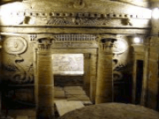
The Catacombs (meaning underground tunnels) lie in the district of Karmouz to the east of Alexandria. The area was called Kom El-Shouqafa or a pile of shards.
The cemetery dates back to the 1st century A.D and was used until the 4th century A.D. It was discovered in 1900 when by pure chance, a donkey drawn cart fell into a pit, which led to the discovery.
The Catacombs in Alexandria are so called because the design was very similar to the Christian Catacombs in Rome.
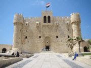
The Qaitbay Citadel in Alexandria is considered one of the most important defensive strongholds, not only in Egypt, but also along the Mediterranean Sea coast. It formulated an important part of the fortification system of Alexandria in the 15th century A.D.
The Citadel is situated at the entrance of the eastern harbour on the eastern point of the Pharos Island. It was erected on the exact site of the famous Lighthouse of Alexandria, which was one of the Seven Wonders of the Ancient World. The lighthouse continued to function until the time of the Arab conquest, then several disasters occurred and the shape of the lighthouse was changed to some extent, but it still continued to function.
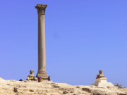
An approximately 25m red Aswan granite column with a circumference of 9m, was constructed in honor of the Emperor Diocletain. Originally from the temple of the Serapis, it was once a magnificent structure rivaling the Soma and the Caesareum. Nearby are subterranean galleries where sacred Apis bulls were buried, and three sphinxes. After his defeat by Julius Caesar in the civil war, Pompey fled to Egypt where he was murdered in 48 BC; mediaeval travelers later believed he must be buried here, and that the capital atop the corner served as a container for his head. In fact, the pillar was raised in honor of Diocletain at the very end of the 4th century. Diocletain captured Alexandria after it had been under siege. The Arabs called it “Amoud el-Sawari”, Column of the Horsemen. The Pillar is the tallest ancient monument in Alexandria.

Nothing remains of the Temple of Augustus. Founded by Cleopatra in honor of Mark Antony, it may well be in this temple that Cleopatra committed suicide in 30 BC. The temple stood near the shore at the center of the great harbor. It was a lavish temple with porticoes, propylalea, parks and libraries. The temple was rededicated to Caesar Augustus, Mark Antonio’s conqueror. With the adoption of Christianity, it became the Cathedral of Alexandria in the 4th century AD. It was destroyed in 912 AD. In front of the temple stood two red granite obelisks called “Cleopatra’s Needles”, though they bear the names of Tuthmosis III, Seti I and Ramesses II. The obelisks were brought to Alexandria from Heliopolis by the Romans 20 years after Cleopatra’s death. These giant Obelisks stayed still facing the old Harbor until 1877, when the British forces took them and shipped them away. One was removed to the Thames Embankment in London, and the other was taken to New York where it stands in Central Park. The statue of a great Alexandrine Nationalist called Saad Zaghloul is standing in the same location where Caesareum used to be. The statue is surrounded with a park which is considered to be one of the busiest squares in Alexandria.
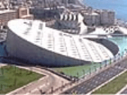
The New Library of Alexandria, the New Bibliotheca Alexandrina is dedicated to recapture the spirit of openness and scholarship of the original Bibliotheca Alexandrina. It is much more than a library. It contains:
• A Library that can hold millions of books.
• An Internet Archive
• Six specialized libraries for (i) Arts, multimedia and audio-visual materials, (ii) the visually impaired, (iii) children, (iv) the young, (v) microforms, and (vi) rare books and special collections
• Four Museums for (i) Antiquities, (ii) Manuscripts, (iii) Sadat and (iv) the History of Science
• A Planetarium
• An Exploratorium for children’s exposure to science (ALEXploratorium)
• Culturama: a cultural panorama over nine screens, the first ever patented 9-projector interactive system. Winner of many awards, the Culturama, developed by CULTNAT, allows the presentation of a wealth of data layers, where the presenter can click on an item and go to a new level of detail. It is a remarkably informative and attractive multi-media presentation of Egypt’s heritage across 5000 years of history to these modern times, with highlights and examples of Ancient Egyptian and Coptic/Muslim heritage.
• VISTA (The Virtual Immersive Science and Technology Applications system) is an interactive Virtual Reality environment, allowing researchers to transform two-dimensional data sets into 3-D simulations, and to step inside them. A practical tool of visualization during research, VISTA helps researchers to simulate the behavior of natural or human-engineered systems, instead of merely observing a system or building a physical model.
• Eight academic research centers: (i) Alexandria and Mediterranean Research Center (Alex-Med), (ii) Arts Center, (iii) Calligraphy Center, (iv) Center for Special Studies and Programs (CSSP), (v) International School of Information Studies (ISIS), (vi) Manuscript Center, (vii) Center for the Documentation of Cultural and Natural Heritage (CultNat, located in Cairo), and (viii) Alexandria Center for Hellenistic Studies.
• Nine permanent exhibitions covering (i) Impressions of Alexandria: The Awad Collection, (ii) The World of Shadi Abdel Salam, (iii) Arabic Calligraphy, (iv) The History of Printing, (v) The Artist’s Book, (vi) Arab-Muslim Medieval Instruments of Astronomy and Science, (vii) Mohie El Din Hussein: A Creative Journey, (viii) Abdel Salam Eid, and (ix) Raaya El-Nimr and Abdel-Ghani Abou El-Enein.
• Four art galleries for temporary exhibitions
• A Conference Center for thousands of persons
• A Dialogue Forum which provides opportunities for the meeting of, and discussions with thinkers, authors and writers to discuss various salient issues affecting modern societies. The Arab Reform Forum was the product of the first Arab Reform Conference organized in 2004.
The New Library of Alexandria also hosts a number of institutions:
• The Academia Bibliotheca Alexandrinae (ABA)
• Arabic Society for Ethics in Science & Technology (ASEST)
• The Anna Lindh Foundation for Dialogue between Cultures, the first Euro–Med foundation based outside Europe
• The Institute for Peace Studies (IPS) of the Suzanne Mubarak Women for Peace Movement
• The HCM Medical Research project (located in Shallalat premises)
• The Jean-Rene Dupuy Center for Law and Development
• The Arab Regional Office of the Academy of Science for the Developing World (ARO-TWAS)
• The International Federation for Library Associations (IFLA) Regional Office
• The Secretariat of the Arab National Commissions of UNESCO
• The Middle Eastern and North African Network for Environmental Economics (MENANEE)
The number is growing and the Library of Alexandria is becoming the nerve center of many international and regional networks.

Luxor has often been called the worlds greatest open air museum, as indeed it is and much more. The number and preservation of the monuments in the Luxor area are unparalleled anywhere else in the world that know of. Actually, what most people think of as Luxor is really three different areas, consisting of the City of Luxor on the East side of the Nile, the town of Karnak just north of Luxor and Thebes, which the ancient Egyptians called Waset, which is on the west side of the Nile across from Luxor.

The Temple of Karnak is the largest Temple in the World! The complex contains a group of Temples such as the Great Temple of Amon Ra, The Temple of Khonso, The Ipt Temple, The Temple of Ptah, the Temple of Montho and the Temple of the God Osiris. A 20m high, mud brick enclosure wall, surrounded all of these buildings.
In ancient Egypt, the power of the god Amun of Thebes gradually increased during the early New Kingdom, and after the short persecution led by Akhenaten, it rose to its apex. In the reign of Ramesses III, more than two thirds of the property owned by the temples belonged to Amun, evidenced by the stupendous buildings at Karnak. Although badly ruined, no site in Egypt is more impressive than Karnak. It is the largest temple complex ever built by man, and represents the combined achievement of many generations of ancient builders. The Temple of Karnak is actually three main temples, smaller enclosed temples, and several outer temples located about three kilometers north of Luxor, Egypt situated on 100 ha (247 acres) of land. Karnak is actually the sites modern name. Its ancient name was Ipet-isut, meaning “The Most Select (or Sacred) of Places”.
This vast complex was built and enlarged over a thirteen hundred year period. The three main temples of Mut, Montu and Amun are enclosed by enormous brick walls. The Open Air Museum is located to the north of the first courtyard, across from the Sacred Lake. The main complex, The Temple of Amun, is situated in the center of the entire complex. The Temple of Monthu is to the north of the Temple of Amun, and next to it, on the inside of the enclosure wall is the Temple of Ptah, while the Temple of Mut is to the south. There is also the small Temple dedicated to Khonsu, and next to it, an even smaller Temple of Opet. Actually, there are a number of smaller temples and chapels spread about Karnak, such as the Temple of Osiris Hek-Djet (Heqadjet), which is actually inside the enclosure wall of the Temple of Amun
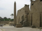
Luxor Temple, or The Temple of Luxor, is among the most beautiful Temples in Egypt. It was known in the New Kingdom period as Ipt-Rsyt, which means the southern shrine. This was to differentiate between this Temple and Karnak Temple, which was the northern house of Amon Ra
Many festivals were celebrated in Thebes. The Temple of Luxor was the center of the most important one, the festival of Opet. Built largely by Amenhotep III and Ramesses II, it appears that the temple’s purpose was for a suitable setting for the rituals of the festival
The name Luxor represents both the present-day metropolis that was ancient Thebes, and the temple on the eastern bank which adjoins the town. “Luxor” derives from the Arabic al-uksur, meaning “fortifications”. That name in addition was adapted from the Latin castrum which referred to the Roman fort built around the temple in the later third century AD. The temple of Luxor has, since its inception, always been a sacred site. After Egypt’s pagan period, a Christian church and monastery was located here, and after that, a mosque (13th century Mosque of Abu el-Haggag) was built that continues to be used today.

Amenhotep III (18th Dynasty) built a mortuary temple in Thebes that was guarded by two gigantic statues on the outer gates. All that remains now are the 23 meter (75 ft) high, one thousand ton statues of Amenhotep III. Though damaged by nature and ancient tourists, the statues are still impressive.

Luxor has often been called the worlds greatest open air museum, as indeed it is and much more. The number and preservation of the monuments in the Luxor area are unparalleled anywhere else in the world that know of. Actually, what most people think of as Luxor is really three different areas, consisting of the City of Luxor on the East side of the Nile, the town of Karnak just north of Luxor and Thebes, which the ancient Egyptians called Waset, which is on the west side of the Nile across from Luxor.
The Valley of the Kings was the royal cemetery for 62 Pharaohs, and is located on the west bank at Luxor. The only entrance to this place was a long narrow winding path. This was a secret place, where sentries were placed at the entrance of the Valley, as well as along the top of the hills, in the hopes of discouraging tomb robbers, who had in the past plundered all royal tombs, including the treasures of the Pyramids! Some thefts were probably carefully planned, but others were spur of the moment, as when an earlier tomb was accidentally discovered while cutting a new one and workmen took advantage of the opportunity

The Valley of the Queens is located on the West Bank at Luxor (ancient Thebes). There are between 75 and 80 tombs in the Valley of the Queens, or Biban al-Harim. These belong to Queens of the 18th, 19th and 20th Dynasties.
The Valley of the Queens is an isolated cemetery, at the southern part of the vast necropolis of Thebes, on the west bank of Luxor. It contains about 70 tombs, mainly belonging to Queens, Princesses, Princes and Nobles, who lived during the XIX and XX Dynasties.
In general, these tombs are smaller than the ones of the Kings. The plans of these tombs usually consist of a small antechamber, a long narrow corridor with several side chambers, and at the end – the burial chamber.
One of the most important tombs in the valley is the one that belongs to the famous Queen Nefertari, the principal consort of King Ramses II.

The nobles holding high quarters under the Pharaohs were buried in tombs in the Valley of the Nobles in Luxor. Most of the nobles whose tombs are built here belong to the 18th Dynasty of the New Kingdom era. The spectacular carvings, relief work and paintings of these tombs in the valley of nobles depict more scenes from the day to day lives and courtly and family affairs of the noble. In sharp contrast to these stands out the wall art of the tombs of Pharaohs in the Valley of the Kings where the themes are mostly philosophical, religious and metaphysical. The paintings and sketches are exquisite representations of court fanfare and entertainment, of the ‘closed door’ politics and the women centric intrigues of the nobility.
The Valley of The Nobles is located on the west bank of Luxor, in an area called Sheik Abd El-Korna. The site has rock cut tombs of Nobles, and high officials of ancient Egypt, who once served the Pharaohs during the time of the New Kingdom. (1500 – 500 BC)
Among the most important tombs in this cemetery is the tomb numbered 55, which belonged to Ra-Mose. He was the mayor of Thebes, and during the end of the reign of Amenhotep III (Amenophis III) and his son Akhenaton, the vizier.

The Temple of Deir El-Bahri is one of the most characteristic temples in the whole of Egypt, due to its design and decorations. It was built of limestone, not sandstone like most of the other funerary temples of the New Kingdom period.
The mortuary temple of Queen Hatshepsut is one of the most dramatically situated in the world. The queen’s architect, Senenmut, designed it and set it at the head of a valley overshadowed by the Peak of the Thebes, the “Lover of Silence,” where lived the goddess who presided over the necropolis. A tree lined avenue of sphinxes led up to the temple, and ramps led from terrace to terrace. The porticoes on the lowest terrace are out of proportion and coloring with the rest of the building. They were restored in 1906 to protect the celebrated reliefs depicting the transport of obelisks by barge to Karnak and the miraculous birth of Queen Hatshepsut. Reliefs on the south side of the middle terrace show the queen’s expedition by way of the Red Sea to Punt, the land of incense. Along the front of the upper terrace, a line of large, gently smiling Osirid statues of the queen looked out over the valley. In the shade of the colonnade behind, brightly painted reliefs decorated the walls. Throughout the temple, statues and sphinxes of the queen proliferated. Many of them have been reconstructed, with patience and ingenuity
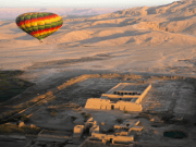
In ancient times Madinat Habu was known as Djanet and according to ancient belief was the place were Amun first appeared. Both Hatshepsut and Tuthmosis III built a temple dedicated to Amun here and Later Rameses III constructed his larger memorial temple on the site.
During his time Djanet became the administrative centre of Western Thebes. The whole temple complex was surrounded by a massive fortified enclosure wall, with an unusual gateway at the eastern entrance, known as the pavilion gate. This structure, a copy of a Syrian migdol fortresses is something you would no expect to see in Egypt. Rameses III, a military man probably saw the virtue in such a structure. It is likely Rameses resided here from time to time because a royal palace was attached at the south of the open forecourt of this temple, while priests’ dwellings and administrative buildings lay on either side of the temple. Originally a canal with a harbour outside the entrance, connected the temple to the Nile. But this was obliterated by the desert long ago.
In later times, because of its strong fortifications, it was the place of refuge during the civil war between the High Priest of Amun at Karnak and the viceroy of Kush. In the period of the Twenty Fifth and Twenty Sixth Dynasties (700 BC) the wives of Amon were worshipped in the Chapels called the Divine Adoratrices of Amun. During the Greek and Roman periods the site was expanded and between the 1st and 9th centuries AD a Coptic city was built and the temple was used as a Christen church.
The exterior walls are carved with religious scenes and portrayals of Rameses III’s wars against the Libyans and the Sea Peoples. The first pylon depicts the king smiting his enemies and also has a list of conquered lands. The interior walls also have a wealth of well preserved bas-reliefs some of which still retain their original paint work.
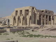
Ramses II built the Temple of the Ramesseum as a funerary Temple in 1304-1207 B.C, and it was dedicated to the God Ra. Most of the Temple is in a very bad condition nowadays, or in ruins. The entrance to the Temple once had two pylons that have now collapsed. In the first courtyard, of the Temple, there is only a colonnaded hall that has survived.

The temple that the Greeks called the Memnonium in Abydos, actually dedicated to Seti I, Osiris and Isis along with Ptah, Ptah-Sokar, Nefertem, Re-Horakhty, Amun, and Horus, is one of the major archaeological sites in that region. It was begun by Seti I and finished by his son, the great Ramesses II. In fact, this structure built of fine white limestone is actually one of the most impressive religious structures in Egypt.
The present facade of the Temple was once the backdrop to the second of the two courtyards, the first of which, along with its entrance pylon, have long since fallen into ruin.
The temple, in the shape of an L, once had a landing quay, a ramp, a front terrace, two pylons, though the outer one is mostly lost, with two courts and pillared porticoes, followed by two hypostyle halls and seven chapels, with additional chambers to the south making up the short leg of the L. Storage chambers fill the area from the southern wing to the front of the temple. The main body of the temple was symmetrical back to the seven chapels. While the L shaped floor plan of this temple is unusual, analysis seems to show that the southern wing was no afterthought, but the result of a well thought out alternative to the usual axial temple plan.
The Temple of Abydos is located to the west of El-Baliana, which is a town in Sohag Governorate. In ancient times it was called Abdu, and the Greeks called it Abydos. The 8th province in ancient Egypt, this area is considered to be amongst the most famous archaeological sites. It was the city were Menna, the unifier of upper and lower Egypt, came from, and from the 11th Dynasty onwards, a burial in Abydos was the ultimate wish, and honor, for any local to have.
In Abydos, many tombs were found belonging to the 1st and 2nd Dynasties. Also, many Kings have built Temples here, including King Pepi I, King Ahmose I, King Seti I and King Ramses II.

Dotted about the landscape of modern Egypt are many ancient temples from the Mediterranean coast all the way to the southern border with the Sudan, most located in the Nile Valley but scattered elsewhere as well. Some of these temples are famous and stand out from the others, such the Temples of Luxor and Karnak, Philae, Kom Ombo, Esna, Edfu and others. Among these most important temples may also be counted Dendera, which provides examples of a particularly rich variety of later temple features.
Dendera is located about 60 kilometers north of Luxor on the west bank of the Nile River opposite the provincial modern town of Qena.
Ancient Egyptian Iunet or Tantere, known to the Greeks as Tentyris, was the capital of the 6th nome of Upper Egypt and a town of some importance. Today, we know it as Dendera, though the population of the town has, since antiquity, moved to Qena across the Nile on the east bank. Now, the ancient temple lies isolated on the desert edge.

Aswan is the 3rd largest city in Egypt, and the biggest in Upper Egypt! It is also one of the favorite places for tourists to visit.
Aswan, Egypt’s sunniest southern city and ancient frontier town located about 81 miles south of Luxor, has a distinctively African atmosphere. Its ancient Egyptian name was Syene. Small enough to walk around and graced with the most beautiful setting on the Nile, the pace of life is slow and relaxing. Days can be spent strolling up and down the broad Corniche watching the sailboats etch the sky with their tall masts or sitting in floating restaurants listening to Nubian music and eating freshly caught fish.
In Aswan the Nile is at its most beautiful, flowing through amber desert and granite rocks, round emerald islands covered in palm groves and tropical plants. Explore the souk, full of the scent and color of spices, perfumes, scarves and baskets. View the spectacular sunsets while having tea on the terrace of the Old Cataract Hotel (Named due to the location of the Nile’s first cataract located here). Aswan has been a favorite winter resort since the beginning of the nineteenth century, and it’s still a perfect place to get away from it all.
Every night Nubian dancers and musicians perform in the Cultural Center, just off the Corniche. Folklore troupes recreate scenes from village life and perform the famous Nubian mock stick-fight dances.

Philae Island was a rocky island in the middle of the River Nile, south of Aswan. It was called in Hieroglyphic “Apo” which means Ivory. It was also known by the Greek “Elephantine”, most probably because it was an important centre of trade, especially for ivory.
The Ancient Egyptians built a beautiful and magnificent Temple on this island for the Goddess Isis, but the Temple became submerged after the first Aswan dam was built in 1906, and it was not until the seventies that many nations attempted to save the Temple. All these countries, together with UNESCO, selected a suitable place, but they had to wait until the completion of the High Dam, in 1971, which would stabilize the level of the water around their chosen island. The new island was called Egilica (also called Agilika), and it was completely reshaped to imitate Philae Island as closely as possible.
One of the main sites visited by almost every tour to Egypt is what is billed as Philae, but Philae is actually a nonexistent island now buried beneath Lake Nasser. The island was sometimes visible and sometimes not after the Old Aswan Dam was built, but was permanently submerged by the High Dam.
Philae is an approximate Greek rendering of the local name “Pilak” known from hieroglyphic texts and which may be Nubian in origin. The ancient Egyptians saw in their name for Philae an etymology with the meaning “island of the time [of Ra]”, i.e. creation, but the island’s history is later than that.
What we refer to today as Philae is the main temple complex relocated from that island, after the High Dam was built, to the island of Agilika. It was the center of the cult of the goddess Isis and her connection with Osiris, Horus, and the Kingship, during the Ptolemaic period of Egyptian History.
During early times, the priests of Philae claimed that the source of the Nile was bottomless and lay beneath the rocks of Biggeh, where half the river rose to flow north and half to flow south. Their rivals were the priests of Elephantine, who made the same claim. Indeed, the river around these islands was even then over one hundred feet deep in places, with confusing waters that could twist and turn in all directions.
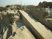
As seen at the temple at Karnak, obelisks were sometimes put in front of or into temples, where they acted as “antennas”, drawing cosmic energy down to Earth. As religion had an overwhelming power in the lives of the Egyptians, religious artifacts, like the obelisks, were produced, transported and erected regardless of their great cost and labor.
One of the really ambitious ones, which was however never finished because of a fatal crack, is the unfinished obelisk at the ancient granite quarry at Aswan. If finished, it would have been a mind-boggling 41.75 meters (app. 137 feet) high – higher than any Egyptian obelisk that were ever actually erected.
Had it been finished, it is estimated that it would have weighed a gigantic 1,168 tons! Consider the level of technology available, and the fact that the main mode of transportation was by boat on the Nile. Also consider that the obelisks, erected at the Karnak temple by Queen Hatshepsut, were sailed by boat there from Aswan. That’s 177 kilometers (110 miles) away in a direct line. Production, transport and erection reportedly only took months. Granted, they were a bit smaller than the unfinished obelisk, but still more than 30 meters high.
Being at the quarry, just how did they get create these giant single pieces of rock out of the mountainside? They made a row of holes app. 10 centimeters (4 inches) wide, and inserted wood in the holes. Then they poured water on the wood. The wood then expands by such force because of the water that the rock splits.
Why was this obelisk unfinished? Because a fatal crack was discovered – one too deep to be dealt with. Because of it, the obelisk could not be the one-piece job that was required, if the cosmic energy was to be able to travel down through it. And who wants a defect antenna?

Located near Aswan, the world famous High Dam was an engineering miracle when it was built in the 1960s. It contains 18 times the material used in the Great Pyramid of Cheops. The Dam is 11,811 feet long, 3215 feet thick at the base and and 364 feet tall. Today it provides irrigation and electricity for the whole of Egypt and, together with the old Aswan Dam built by the British between 1898 and 1902`, 6km down river, wonderful views for visitors. From the top of the two Mile long High Dam you can gaze across Lake Nassar, the huge reservoir created when it was built, to Kalabsha temple in the south and the huge power station to the north.
The High Dam created a 30% increase in the cultivatable land in Egypt, and raised the water table for the Shara as far away as Algeria. The electricity producing capability of the Dam doubled Egypt’s available supply.
The High Dam added an whole new aspect to Egypt, and a new environment as well. The lake is some 500 miles long and at the time it was built, if not now, was the world’s largest artificial lake.

Edfu was the Greek city of Apollinopolis Magna, and is a religious and commercial center. Located about 33 miles south of Esna and 65 miles north of Aswan, this friendly town with approximately 274,500 inhabitants now produces sugar and pottery.
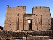
Dedicated to Horus, the falcon headed god, it was built during the reigns of six Ptolemies. We have a great deal of information about its construction from reliefs on outer areas. It was begun in 237 BC by Ptolemy III Euergetes I and was finished in 57 BC. Most of the work continued throughout this period with a brief interlude of 20 years while there was unrest during the period of Ptolemy IV and Ptolemy V Epiphanes.
This is not only the best preserved ancient temple in Egypt, but the second largest after Karnak. It was believed that the temple was built on the site of the great battle between Horus and Seth. Hence, the current temple was but the last in a long series of temples build on this location. It is said that the original structure housing a statue of Horus was a grass hut built in prehistoric times. At any rate, there is an earlier and smaller pylon of Ramesses II which sits in a 90 degree angle to the current building.

The Town of Kom Ombo with approximately 274,500 inhabitants is located about 45 km north of Aswan. The local industry is primarily agriculture, including irrigated sugar cane and corn. Besides the native Egyptians, there is a large population of Nubians who were displaced from their land when Lake Nasser was created.

The major attraction here is the Temple of Kom Ombo, built during the GrecoRoman period (332 BC AD 395). The temple is very unusual. It was dedicated to two deities, each with their own associated chambers and sanctuaries. On the eastern side of the temple, the crocodile god Sobek (Seth), is honored with his wife who is here named as Hathor and their son Khonsu. On the west side, Haroeris or ‘Horus’ is accompanied by his wife Hathor-ta-sent-nefert and their son Panebtawy (Lord of the Two Lands).
Located in the town of Kom-Ombo, about 28 miles north of Aswan, the Temple, dating to the Ptolemies, is built on a high dune overlooking the Nile. The actual temple was started by Ptolemy VI Philometor in the early second century BC. Ptolemy XIII built the outer and inner hypostyle halls. The outer enclosure wall and part of the court were built by Augustus sometime after 30 BC, and are mostly gone. There are also tombs from the Old Kingdom in the vicinity of Kom-Ombo village.
The Temple known as Kom Ombo is actually two temples consisting of a Temple to Sobek and a Temple of Haroeris. In ancient times, sacred crocodiles basked in the sun on the river bank near here. The Temple has scant remains, due first to the changing Nile, then the Copts who once used it as a church, and finally by builders who used the stones for new buildings.
Everything is duplicated along the main axis. There are two entrances, two courts, two colonades, two hypostyle halls and two sanctuaries. There were probably even two sets of priests. The left, or northern side is dedicated to Haroeris (sometimes called Harer, Horus the Elder) who was the falcon headed sky god and the right to Sobek (the corcodile headed god). The two gods are accompanied by their families. They include Haroeris’ wife named Tesentnefert, meaning the good sister and his son, Panebtawy. Sobeck likewise is accompanied by his consort, Hathor and son, Khonsu.

180 miles south of Aswan on the shore of Lake Nasser sits what is one of the most intriguing monuments of Egypt — Abu Simbel, possibly the most astounding piece of Pharaonic Egyptian architecture.
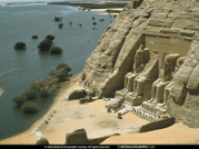
Not only are the two temples at Abu Simbel among the most magnificent monuments in the world but their removal and reconstruction was an historic event in itself. When the temples (280 km from Aswan) were threatened by submersion in Lake Nasser, due to the construction of the High Dam, the Egyptian Government secured the support of UNESCO and launched a world wide appeal. During the salvage operation which began in 1964 and continued until 1968, the two temples were dismantled and raised over 60 meters up the sandstone cliff where they had been built more than 3,000 years before. Here they were reassembled, in the exact same relationship to each other and the sun, and covered with an artificial mountain. Most of the joins in the stone have now been filled by antiquity experts, but inside the temples it is still possible to see where the blocks were cut. You can also go inside the man made dome and see an exhibition of photographs showing the different stages of the massive removal project.
Perhaps after the Giza pyramids, or coincident with them, the great temple of Abu Simbel presents the most familiar image of ancient Egypt to the modern traveler and reader. When the conservation efforts to preserve the temple from the soon-to be built High Aswan Dam and its rising waters were begun in the 1960s, images of the colossal statues filled newspapers and books. The temples were dismantled and relocated in 1968 on the desert plateau, 200 feet above and 600 feet west of their original location.

Hurghada is a city in the Red Sea Governorate of Egypt. It is a tourist center located on the Red Sea coast.
The city was founded in the early 20th century, and since the 1980s has been continually enlarged by Egyptian and foreign investors to become the leading seashore resort on the Red Sea. Holiday villages and hotels provide aquatic sport facilities for sailboarders, yachtsmen, scuba divers and snorkelers.
Hurghada stretches for about 36 kilometres (22 mi) along the seashore, and it does not reach far into the surrounding desert. The resort is a destination for Egyptian tourists from Cairo, the Delta and Upper Egypt, as well as package holiday tourists from Europe, notably Italians, Russians, Czechs and Germans. Until a few years ago it was a small fishing village. Today Hurghada counts 248,000 inhabitants and is divided into three parts: Downtown (El Dahar) is the old part; Sekalla is the city center, and El Memsha (Village road) is the modern part. Sakkala is the relatively modest hotel quarter. Dahar is where the town’s largest bazaar, the post office and the long-distance bus station are situated.
The city is served by the Hurghada International Airport with scheduled passenger traffic to and from Cairo and direct connections with several cities in Europe. The airport has undergone massive renovations to accommodate rising traffic. Hurghada is known for its watersports activities, nightlife and warm weather. Daily temperature hovers round 30 degrees Celsius most of the year. Numerous Europeans spend their Christmas and New Year holidays in Hurghada, primarily Germans and Italians.

The city of Hurghada is another of the major tourist attraction in Egypt. This city draws more than 2.5 million visitors every year, and yields more than 3 billion dollars to Egypt’s economy.
Hurghada is located on the Red Sea coast, almost 550 Km from Cairo. Egyptian’s used to call it Ghardaka, from which the name of the city was derived.
Hurghada stretches for about 60 Km along the Red Sea coast, and has more than 80,000 inhabitants: mostly immigrants from Upper Egypt, seeking investment and work opportunities in the this newly developed sea resort. Hurghada today has more than 170 hotels and it is still developing.
Over the last ten years the citizens of Hurghada have seen an amazing development. From desert sand has risen a town with more than 200 hotels, booming shopping promenades and vibrant nightlife. With ever growing number of tourist and perfect climate, this Red Sea Riviera has no off season. Hurghada has a special community where local habits and culture is presented next to resort lifestyle and behavior.
But the biggest beauty of Hurghada starts where coast ends – blue Red Sea is the reason why your dreams will stay with us. If it takes place in or on the water you can do it here: windsurfing, sailing, deep-sea fishing, swimming, but above all, snorkeling and diving. The unique underwater gardens offshore are some of the finest in the world, justifiably famous amongst divers. The warm waters here are ideal for many varieties of rare fish and coral reefs, which may also be observed through glass bottom boats.

Sheraton road or El Sakala center is the main tourist street in town. It is the busiest street in town with numerous bazaars, coffee shops, supermarkets, pharmacies, banks, restaurants and night clubs. You will find many hotels on the sea side of Sakala. Across the street are situated apartments for locals and foreigners living here (especially Hadaba). Sakala square is located in the one end of the main street. Here you will find many fish restaurants and local eateries. From the beginning of Sakala in a walking distance you will find an El Arousa square – a bride or mermaid standing in the middle of the road. The street to the sea side will lead you to Hurghada Marina – the new city promenade by the marina with luxury yachts and apartments surrounded by old fisherman households. Opened in 2008, one will find in Marina many shops (incl. some high street brands), fabulous bars, fine dining restaurants, nightclubs or just nice walking area for warm summer nights.
The second famous touristic area is called Village road (El Memsha in Arabic). More than 5 km long promenade with wide and clean walking area, mainly 4 stars hotels, famous nightclubs, restaurants with international cuisine, some mall-type shopping centers and uncountable number of shops. For a first acquaintance with Hurghada, Village road is more peaceful and less harassment for tourist than one will experience in Sakala area, but therfore as well reflects much less local culture and lifestyle than any other parts of the town. Famous spots in Village road include Esplanada Mall, Kottas mall, Duty free shop, Little Buddha nightclub and Hard Rock café.

And then there is left El Dahar. Dahar is home for most of the locals living in the area, but as well for number of hotels, city council, aquarium, library, biggest mosques and food market. In Dahar one will find touristic and not so touristic areas, although until now, most of the areas are safe enough to sneak around and discover the other face of Hurghada. If interested in shopping, Dahar offers you streets full of bazaars and good bargains.
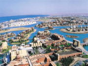
Titled as Venice of Africa, El Gouna was a project of few private villas located on the seashore approximately 20 km from Hurghada airport to North. By now it has grown to be a private city with hotels, private marina, airport, school, hospital and entertainment facilities. El Gouna, with its 10 000 residents, is favorite weekend escape for high class Egyptians and wealthy Europeans. El Gouna is famous for its golf courses and kite surfing, but corals lovers have to travel far from the sandy coasts.

It is the new rising 5 star resort 20 km from Hurghada southwards. The area is described best by quiet, natural and clean environment already with few ultra five stars resorts opened and many yet to come. The coast of Sahl Hasheesh is considered one of the most beautiful, not yet polluted region nearby Hurghada city and therefore also an attraction for high street real estate developers.

Those are areas of fine resorts surrounded by the beautiful coast of Red Sea and desert mountains. Area between Safaga and Hurghada approximately 30 km from Hurghada airport to south, with green hotel territories is suitable for family vacations or tourists seeking for relaxation out of the real world.

Besides tourism, Red Sea area is also famous for its natural resources. Especially the town of Safaga, around 60 km from Hurghada – a port city for ferries from Saudi Arabia and important mining region for natural gas, oil, gold and many other minerals.
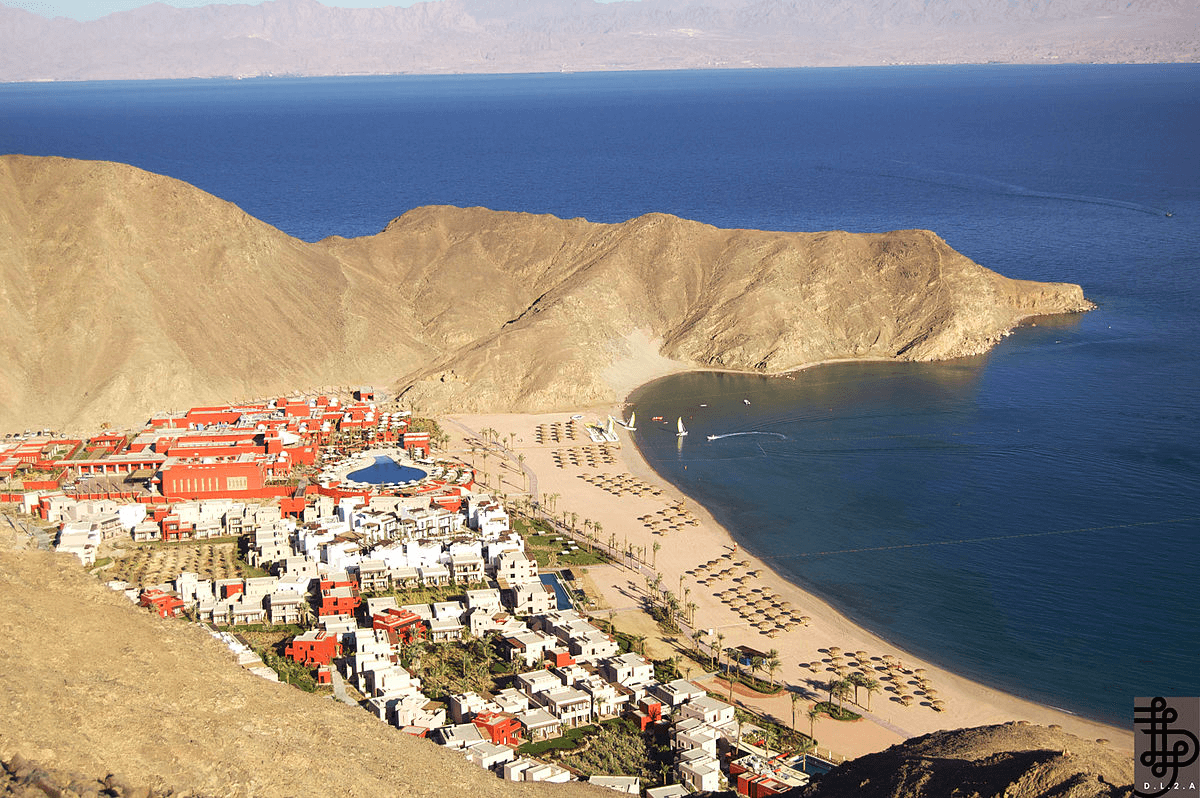
Taba, “The gateway to Sinai” is a beautiful, fast growing resort 75 km north of Nuweiba. Well known for its charming bays and coastline, tourism has blossomed recently with the opening of its International Airport, which has direct flights from many parts of Europe. The 12th century fortress of Saladin on Pharaoh’s Island is a joy to visit as it is in a remarkable condition.
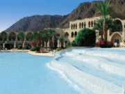
It is surrounded by blue and turquoise waters and its reefs are a paradise for snorkellers and divers.
Just 50 km south of Taba is the stunning Coloured Canyon, a marvel of the natural world and a kaleidescope of colour. The Fjord, another spectacular site, just 15 km south of Taba, is a delightful and protected bay with stunning coral refs and unforgettable scenery.

The town of St. Katherine is in the Sinai peninsula in Egypt at an elevation of about 1600 meters from sea level, at the foot of the Sinai High Mountains. Many visitors come to visit St. Katherine’s Monastery, the oldest continuously inhabited monastery in the World built on the site where Moses (Prophet Musa) talked to God in the miracle of the Burning Bush, and to climb Mt. Sinai (the Biblical Mt. Horeb, known locally as Jebel Musa) where Moses received the Ten Commandments. Most tourists, up to a 1000 each night, arrive on organized tours from the resort towns of Sharm el Sheikh and Dahab in the evening, climb the mountain at dawn, visit the Monastery in the morning and leave right afterwards. They don’t know what they are missing out on: the area has much more to offer than the otherwise indeed spectacular sunrize!
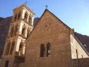
The Monastery of St. Catherine is the oldest continuously inhabited monastery in the World and its library has the largest religious collection next to the Vatican only. It was built by the Byzantine Emperor Justinian in the 6th century AD, although there was already a church at the site of the Burning Bush erected by the Empress Helena in 330 AD. Byzantine Orthodox monasticism has even earlier roots, and the area is sacred to all three monotheistic religions, Judaism, Christianity and Islam. The monastery was under the protection of the Prophet Mohammed, Arab and Turkish leaders and Napoleon, which helped to preserve it virtually undameged. In the walled compound there is a Fatimid mosque built next to the Orthodox church, a rare coexistence of religions in today’s World

Called Mt. Horeb in the Bible and locally known as Jebel Musa (Gebel Musa), Mt Sinai is concidered to be the place where Prophet Moses received the Ten Commandments from God. One of the highest mountains in Egypt, with a small Orthodox church and a mosque on its summit at 2285 meters from sea level. Mt Sinai forms one massif with Jebel Safsafa and Jebel Loza, with many small basins on the top. In these basins there are old churches, small gardens and relics of monastic life. The most common route to the peak is from the Monastery via the “Steps of Repentance ” built by monks or via the camel path built by Viceroy of Egypt, Abbas Hilmi Pasha I., although there are several other less travelled beautiful treks.

The oasis in Egypt comprises the many depressions in the desert regions of Egypt. The desert regions include the Western desert and the Eastern desert, where the climatic conditions are very harsh throughout the year. The only places of relief in the deserts are these oases regions. Though these places are densely populated, it represents only a hundredth of the total population of Egypt. It is the Bedouin tribes in chief, who inhabit these oases regions. Agriculture is the chief means of occupation.

Bahariya Oasis is one of the greatest attractions in Egypt. It is roughly 300 km away from the capital city of Cairo and is situated in the Giza Province. Here, tourists will find an art museum and the major agricultural products including mangoes, dates, guavas and olives.
Bahariya comprises several villages of which Bawiti is the biggest one and also considered to be centre of administration. It is assumed that this Oasis had been a significant agricultural hub in the Pharaonic period and was highly popular for its wine.
Tourists, who are interested in the wildlife, should definitely visit the wonderful Bahariya Oasis in Egypt, since it offers a wide range of Wildlife variety to its visitors.
Another tourist attraction that is located close to the Oasis is the Black and White deserts. The deserts will surely appeal to the tourists with its picturesque ambiance. The Black Desert was mainly formed by the wind erosion when the volcanic mountains were ejected on the desert floor nearby.
Apart from this, there are the remains of the temples and colonies of the 17th Dynasty. The graves where birds were entombed are also located close to this place.

Farafra Oasis is probably the smallest oasis situated in the Western part of Egypt. It is basically located in the desert of Libya, between the regions of Bahariya and Dakhla. Since a long time, this place has been entertaining a large number of international tourists, who come here to get a glance of the nearby hot springs at El-Mufid Lake and the Bir Setta.
However, the main attraction of Farafra lies in its White Desert and Sahara el Beyda. This spectacular White Desert of Egypt is located about 45 km north to Farafra. In the desert, there is a white, cream colored massive chalk rock formation that was formed by the sandstorms.
The Farafra oasis also houses the Farafra Art Museum, which was established by the talented local artist Badr Abdel Moghny Aly. This museum basically exhibits a rich collection of his art works.
The typical architecture of the buildings in this area will also draw the attention of the tourists. Here the houses are made of mud and brick and have doors made of wood. Often, some of the residences are decorated with the paintings of birds, animals, landscapes and the works of Badr, a local artist. Apart from this, the museum and studio depicting his paintings and ceramics are located in a garden of sculptures. Excursions by camel treks and jeep safaris from this place to visit the magnificent White Desert, Dakhla, Bahariya and Siwa can be organized through the restaurant of Saad.

Dakhla Oasis is located to the northwestern part of Kharga and to the southeastern part of Farafra. This oasis comprises 14 settlements and enjoys an approximate population of 70,000 people. Dakhla is probably one of the most splendid oases of Egypt and of course the centre of attraction to the tourists visiting the country.
Dakhla is encircled by pink cliffs. There are around 30,000 acres of cultivated landmass and a major part of these fields and gardens are filled with mulberry trees, figs, citrus fruits and date palms. The specialty of this place is that in spite of its huge size it has still succeeded to retain its charms. Dakhla is the only Egyptian place where new water wheels (driven by buffaloes) are built.
According to the historical evidence, this Oasis had been domiciled since the prehistoric era. There was once a huge lake over here. While taking a trip around the Dakhla Oasis, tourists can also find the magnificent Neolithic rock paintings which indicate that the buffaloes, elephants and ostriches used to come here often. However, since the lake dried, the inhabitants moved to the Nile valley. In the northern part of this oasis, there is a rose-Colored rock wall.

Kharga Oasis is indeed one of the most wonderful places in Egypt as well as in the world. In Kharga Oasis, tourists can enjoy the breathtaking view of nature especially during sunset.
El-Kharga Oasis is around 550 Km away from the Egyptian capital city of Cairo. The major attractions of this place include numerous monuments, the most important of which is the temple of Hebes. It is located around 3 Km north of the Oasis. The temple was devoted to the Triad of Amon, Mut, Thebes and Khonso of the 26th Dynasty.
Besides this, El-Zayan Temple is considered as another interesting site to visit in this area. It probably dates back to the Ptolemaic era and was meant for the cult of Amon-Ra, the God of El-Kharga at the time.
Moreover, the El-Bagawat cemetery is also another attraction of the place. On some of the walls of this cemetery, there are colorful paintings, representing some religious figures including the Adam and Eve, Exodus and Prophets, the Virgin Mary, Angels and Jesus.
Presently, Kharga Oasis has acquired international fame for the huge number of pigeon-houses, farms, fields, palm-trees, wells and traditional handicrafts, springs and honey-colored hilly lands. Here, the tourists can also enjoy camel riding.

Siwa Oasis is situated between the Sand Sea of Egypt in the Libyan Desert and the Qattara Depression. The oasis covers a length of around 80 km and width of around 20 km. Located amidst the lovely natural setting, the Siwa Oasis offers a wide range of panoramic view to its visitors.
This area is highly popular for its olive and date fruits. It is basically situated on the old date caravan route and receives a large number of travelers throughout the year. While talking about the Siwa Oasis, the three-day festival should also be mentioned. It is generally celebrated on the month of October. During this festive season, the people of Siwa try to settle all their conflicts of previous years.
Apart from this, the other remarkable features of this area include the beautiful springs. The water of this region tastes sweet and believed to have medical properties. Currently, Siwa is considered to be a major traditional tourist destination in the country.
It is also assumed that the traditional Siwan House museum is located in the town center and the area offers various craft works, specifically woven clothes that are unique in this country.

This popular resort is located 135 Km south of Al-Qusseir and 270 Km south of Jiving, and is connected to Edfu by a 289 Km long desert road.
Due to the proximity of Luxor and the shrine of Abu AI-Hassan AI-Shazli, it has become a big tourist centre, which avails the tourist of the many monumental sites and its exotic beaches.
Marsa Alam’s International airport was inaugurated a few years ago and now receives many flights each day. The port of Ras Ghareb, which is located about I Km to the north of Marsa Alam, is capable of receiving all luxurious cruises and yachts (both local and international) and can safely handle up to 1000 yachts of all sizes up to a size of 60 metres long and 4 metres deep.

Marsa Alam is one of the fastest growing holiday resorts in Egypt, popular with wind surfers, divers and sun worshippers fortunate enough to have discovered the resort’s remote tranquility.
Although previously a small fishing village, the construction of an International Airport in 2001 has established Marsa Alam as an upcoming and exclusive holiday resort. With a host of tourism projects planned for the near future, Marsa Alam is set to rival the popularity of established Egyptian resorts such as Hurghada and Sharm El Sheikh.

The simplicity of sun, sea and sand. The luxury of five-star hotels, water sports, shopping and entertainment. This is Sharm el-Sheikh, one of the most accessible and developed tourist resort communities on the Sinai peninsula. All around are Bedouins, colorful tents, mountains and sea. There are small, intimate hotels with modern designs, as well as larger hotel complexes belonging to International chains, plus about all the amenities one could expect of a tourist center, including casinos, discos and nightclubs, golf courses and health facilities. In fact, with diving and snorkeling, windsurfing and other water sports, horses and camel riding, desert safaris, and great nearby antiquities attractions, it is almost impossible for a visitor to ever suffer from boredom.
Four miles south the southern section of the town stands on a cliff overlooking the port. and is a great view.
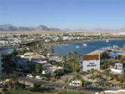
Naama bay is one of the center of the tourist activities. Located just north of Sharm, this area is developing into a resort town of its own. Most hotels at Naama Bay have their own, private beaches with comfortable amenities such as chairs, shades and even bars.

Shark’s Bay is also nearby, and again is a growing resort community with more and more to offer, along with several diving centers.

This pearl of the gulf actually consists of two villages, the Bedouin village of Assalah is the southern half, with the business and administrative center of Dahab to the north. There are also clusters of holiday villages that cater to affluent visitors.
Assalah is the most developed part of Dahab, 2,5 miles up the coat from downtown. Historically, most visitors to Dahab have been backpackers traveling independently and staying in the hostels in this area. It is a sprawling conglomeration of palm trees, shops, campgrounds, hotels, bars and restaurants that lie along the shore of Ghazala Bay. Assalah has a distictly bohemian feel. Less laid back, but still relaxed, is the area just south along El-Qura Bay. Here, upscale luxury holiday villages and dive centers attract a very different clientele.
Dahab means ‘gold’ in Arabic. In Sinai it means golden sands, turquoise sea and off-beat cafe life. It is a focus of tourism development, with swaying palms, fine sand and wonderful snorkeling opportunities. Dahab has excellent hotel accommodations, but also affords less expensive housing in the village, or camping. About 5 miles from town is the famous Blue Hole, for diving. Towards the Israeli border is the Island of Coral, where the Crusaders built a fort. The remains can still be seen.
Dahab was originally a Bedouin fishing village that today is world-renowned for its windsurfing, because of the reliable winds that provide outstanding flat water conditions. However, there are many reefs immediately adjacent to the waterfront hotels, so scuba diving and snorkeling are also very popular sports, especially considering the nearby Blue Hole.

One of the main attractions of Dahab are the unique on-the-ground restaurants, a mixture of Hippie and Bedouin styles developed over several decades. Large cushions and low tables are placed next to the sea, and decorated with colorful cloths. Most of these restaurants have fish stalls in front, where one can pick the fish of one’s choice and have it prepared according to one’s wishes. The menus are delicious, quite affordable, but a bit above the price level of the average Egyptian restaurant. After finishing one’s food, onejust lean back in the cushions and rest for as long as you wish.

Noweiba can be divided into three main sections and runs for some ways along the beach. The three areas consist of the port of Noweiba which has become fairly busy these days, Noweiba City which has a bazaar and tourist shops, and Tarabin which is the real party area of the area.
All along the Sinai cost you will find good scuba diving, and Noweiba is no exception. This town lies either side of the Wadi Watir delta about 57 miles north of Sharm el-Sheikh, and consists of the Muzeina Bedouin fishing village to the south and the Tarabiin Bedouin and tourist villages to the north. They are separated by an 18th century Turkish citadel. Besides the diving, you will also find camel and jeep adventurers. The Colored Canyon is nearby, and a little beyond is the oasis of Ain el-Furtaga. Be sure to take the road between Noweiba and Taba if you like beautiful scenery. Noweiba also has a daily ferry service to the Jordanian port of Aqaba.

The northern part, consists of a thick grove of palms, a shallow bay and the ruins of a Turkish fort. The well inside the ruins has served the Bedouins as a fresh water source for centuries. Tarabin is known for its lively oriental atmosphere. Restaurant by restaurant and bazaar next to bazaar gives you the impression of a colorful oriental market place.
Along the beach you find lively outdoors restaurants furnished in Bedouin style with carpets and cushions that invite to lay back and relax and let the time pass by.

Nuweiba Port or also known as Nuweiba Muzeina is the industrial area. With the construction of the port in 1985 trade business between Egypt and the Arab countries on the other side of the Gulf of Aqaba increased. A highway was built through the mountains connecting mainland Egypt with the Sinai Peninsula. Egyptians from all over the country came to live in Nuweiba as work flourished. Homes and schools were built, shops and business centers opened and the first hotels were established.
Originally Nuweiba port was the summer location for the Muzeina tribe. It was a sparsely inhabited oasis, which came only into life in the late summer, when the Muzeina flocked to the palm groves to pick dates. The thriving trade encouraged the Muzeina clan to settle. They are running their own businesses by renting out their places as shops or other facilities to the Egyptian newcomers.
Here you can provide yourself with some goodies out of the Duty Free. Several Banks to cash your checks or credit cards at one of the ATM machines are close to the port’s entrance and so is the ticket-office where you can purchase your tickets for the ferry to Aqaba, Jordan. However, “Al Mina” is as any common port area scattered with shops and supermarkets. Yet, it is here that you find a good bargain for commodities not available in Nuweiba Town – and of course in the restaurants you find good and cheap local food.